
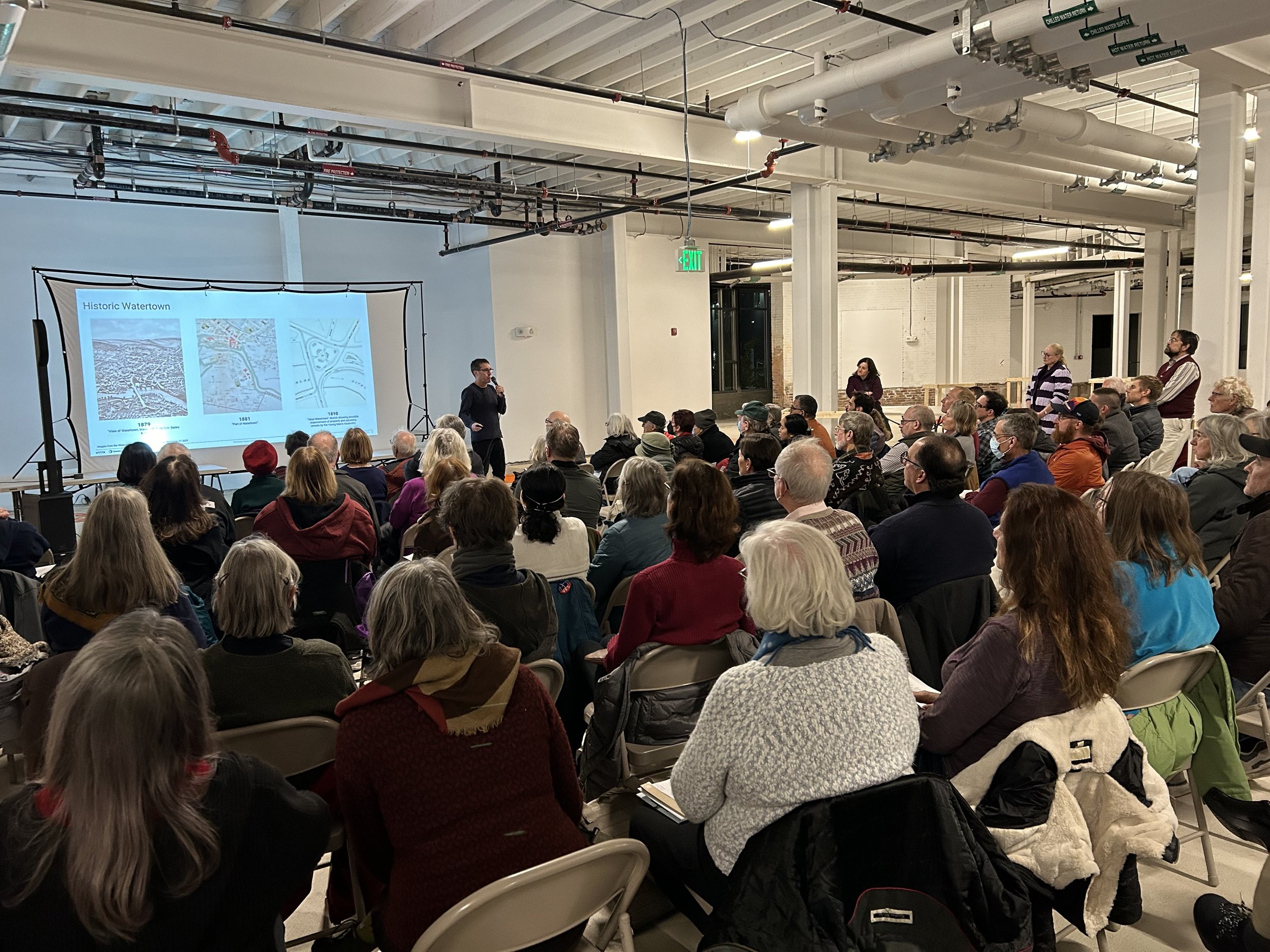
Watertown Square Virtual Open House
Experience the May 20, 2026 Open House at the comfort of home!
Please note that the below open house materials only covers the topics related to the Demonstration Project and Urban Revitalization Plan. Information related to the streetscape redesign project will be released soon.
Introduction
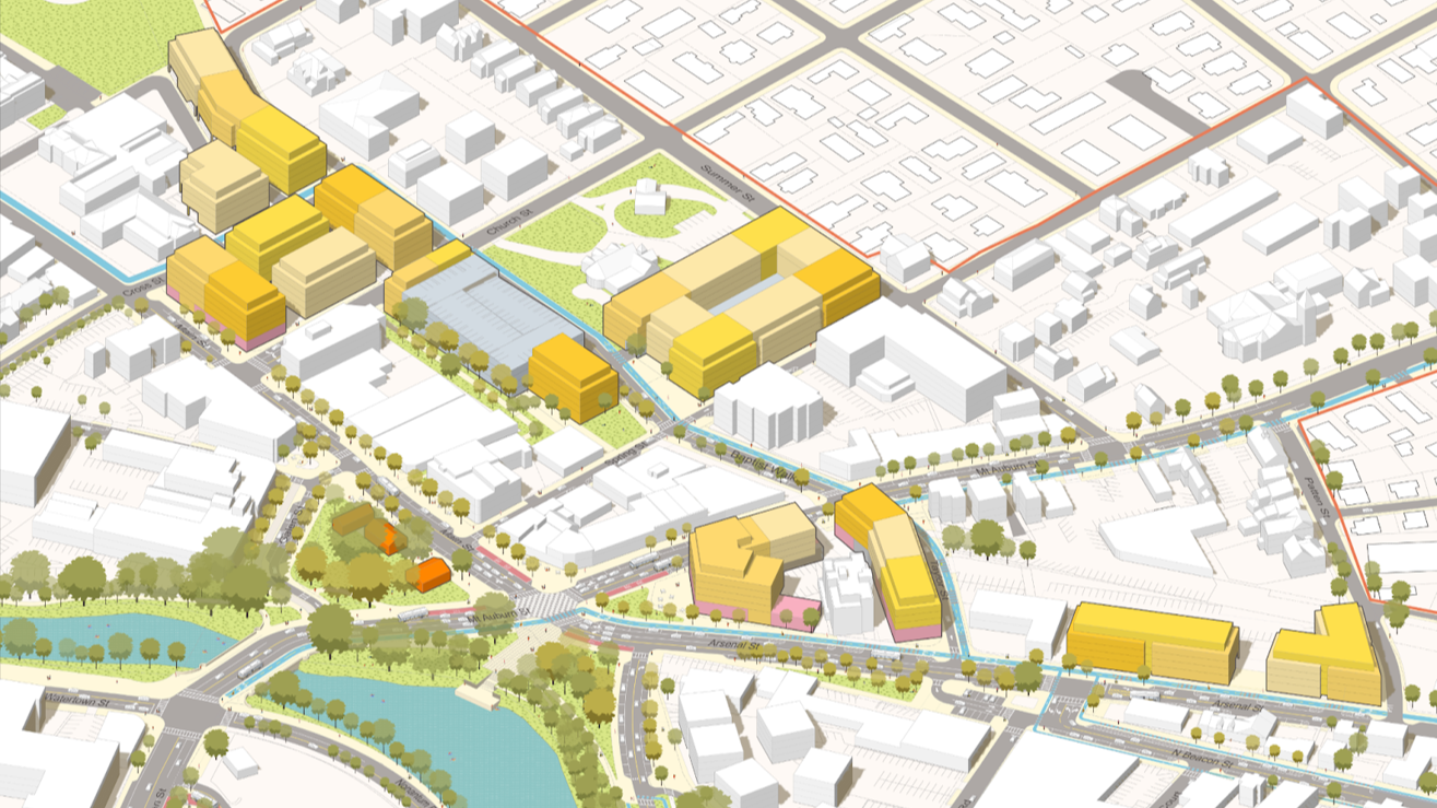
These images demonstrate how the goals of the 2024 Watertown Square Area Plan can be achieved through public-private partnerships and investment in this specific area.
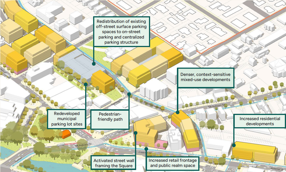
Four Corners Axonometric Concept
Four Corners Streetscape Concept
How did we get here?
Foundation documents include the 2022 Resilient Watertown Climate & Energy Plan, the 2023 Watertown Comprehensive Plan, and the 2024 Watertown Square Area Plan.
Plan Goals
Why plan for Watertown Square?
Add housing capacity
Increase and improve parking availability and access to local businesses
Improve access to and through Watertown Square for pedestrians and bicyclists
Add a destination area for the community to support event programming
To create lively public spaces;
To create street design that promotes safe walking and biking;
To ensure that small businesses can thrive;
To promote shared public-private open spaces that are activated and expanded, with more access to the Charles River;
To create expanded housing options;
To explore more opportunities for public art;
To reuse, enhance, or preserve the Square’s most significant historic structures; and
To make the Square a destination for residents and visitors alike, with attractions for community members to visit and spend time.
Watertown Square Area Plan Timeline


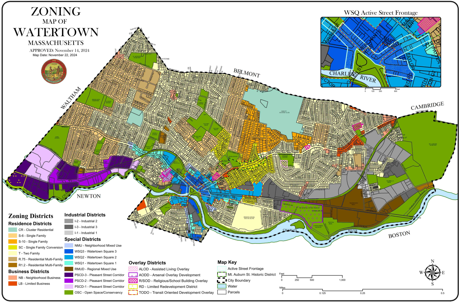

Watertown’s Zoning Map once rezoning was approved on November 14, 2024 as part of the Watertown Square implementation process. See an interactive map.
Site History | Changes over Time
Knowing the history of the site allows the City to understand where buildings and open space can - and cannot - be located.
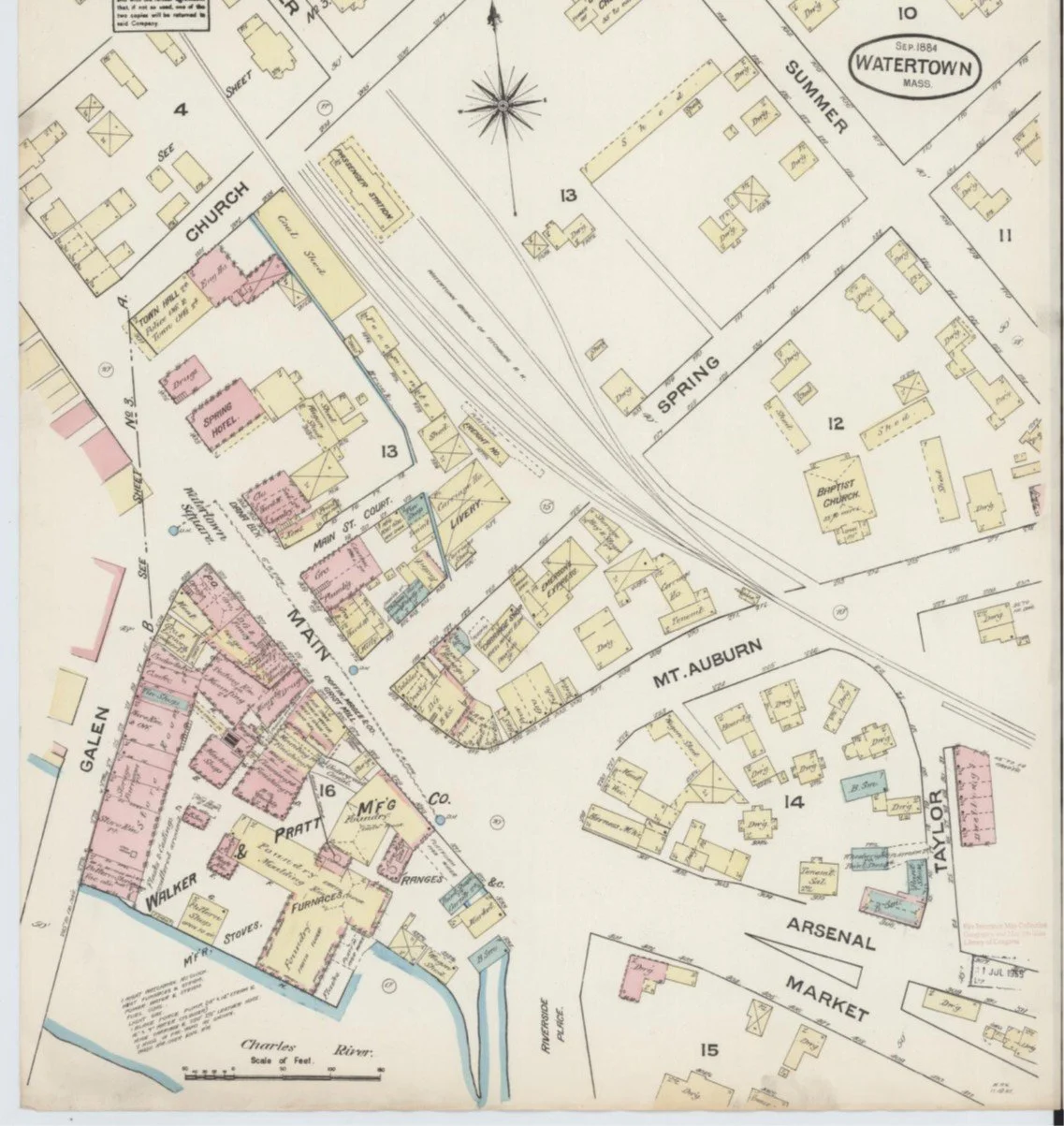
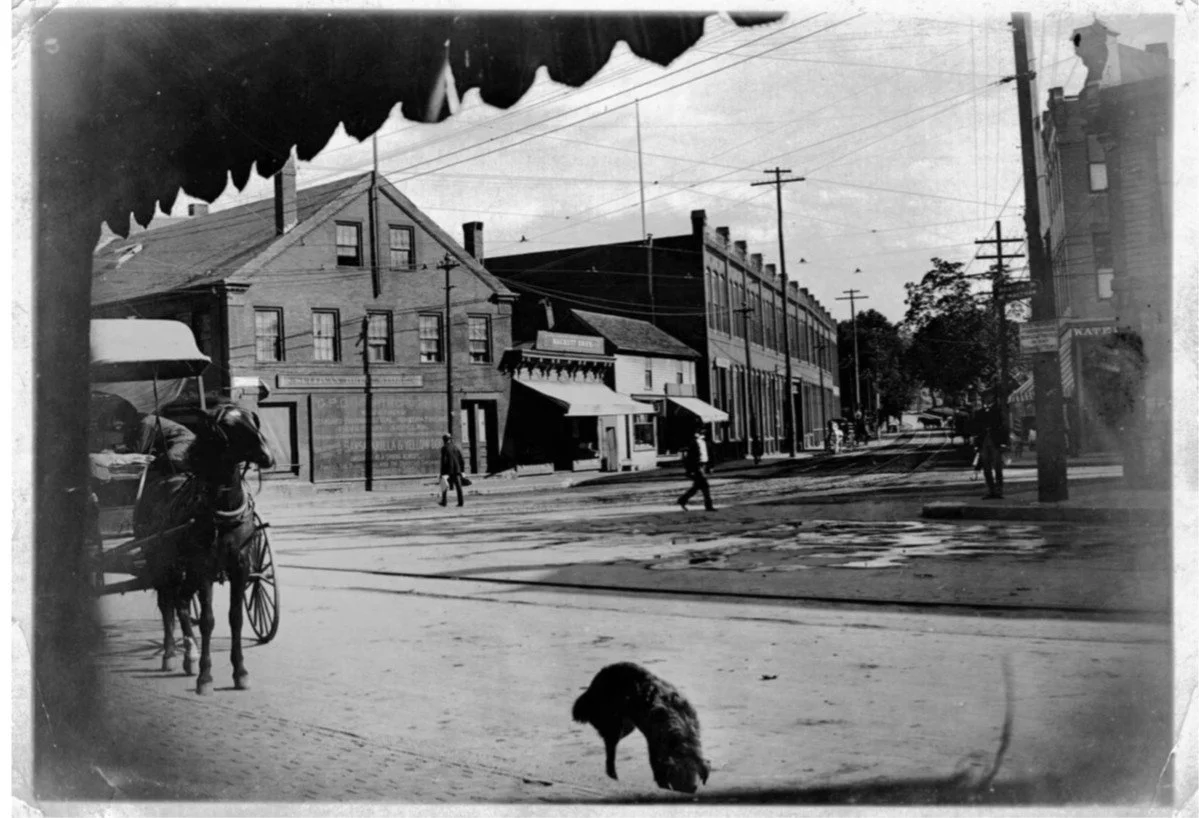
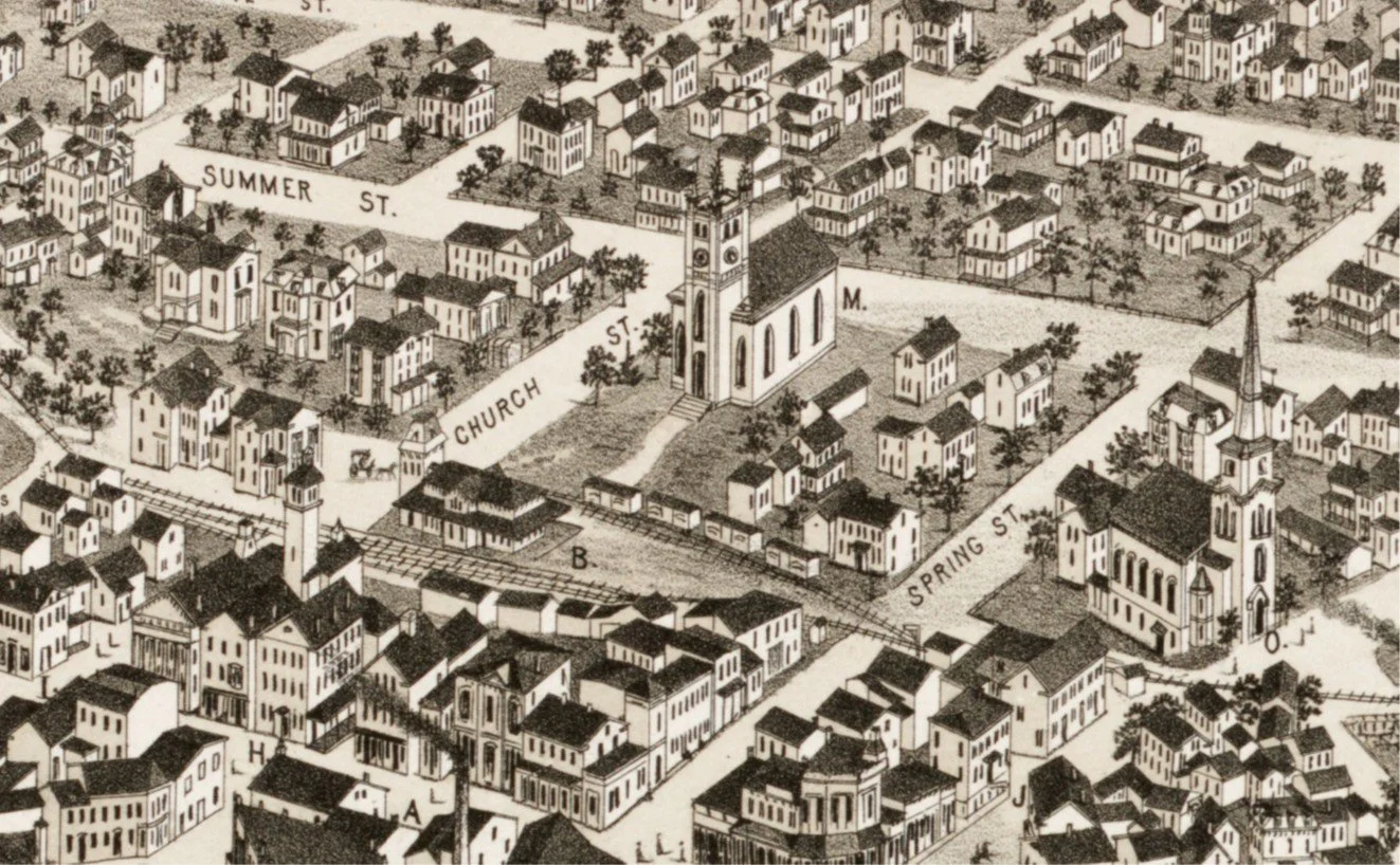
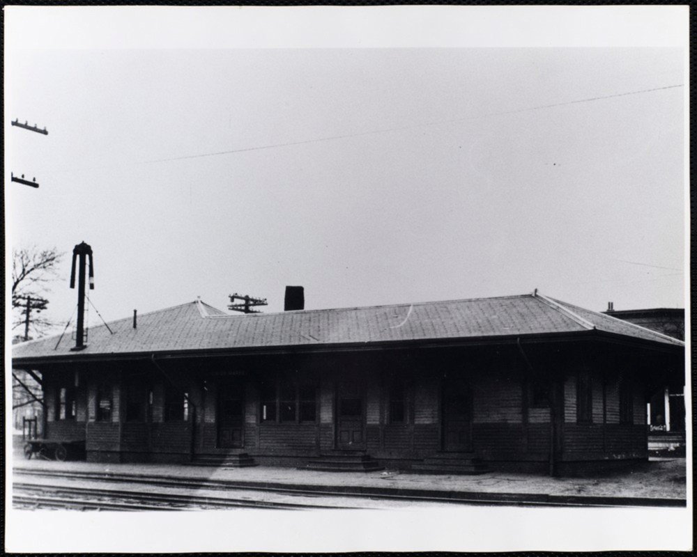
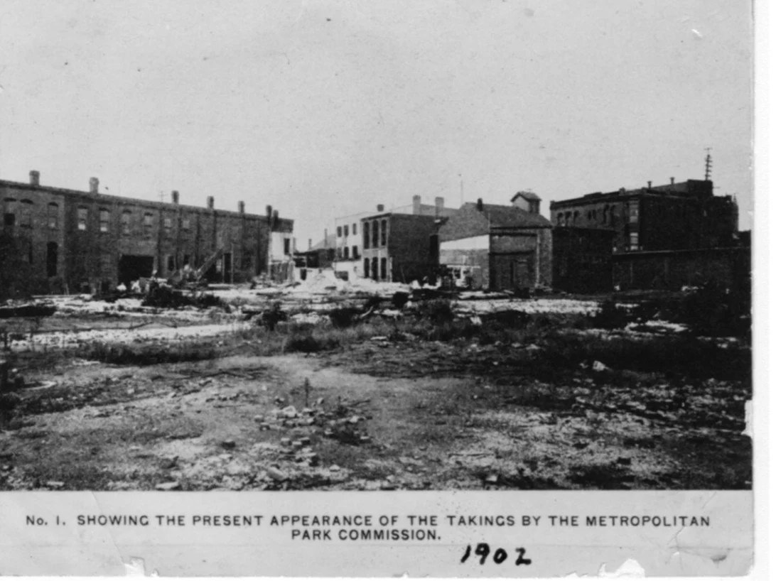
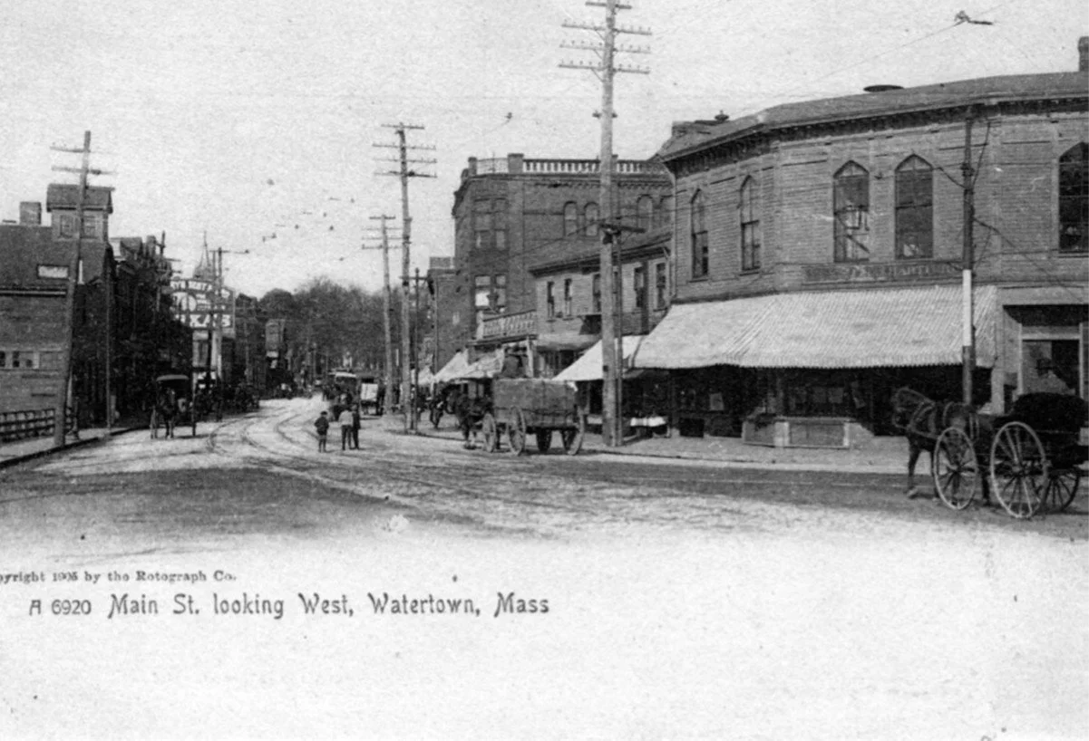
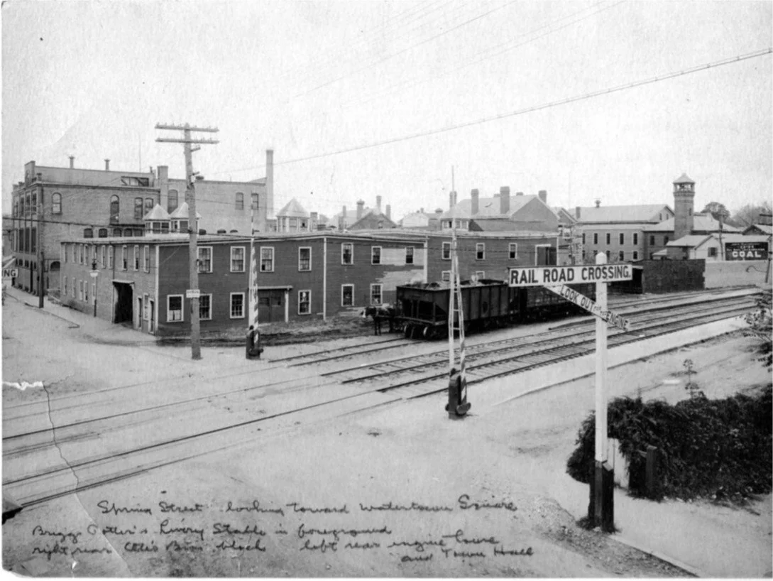
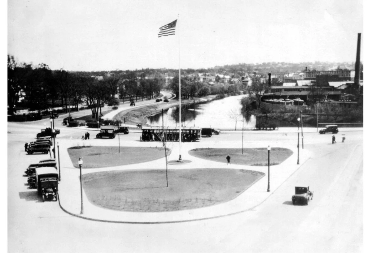
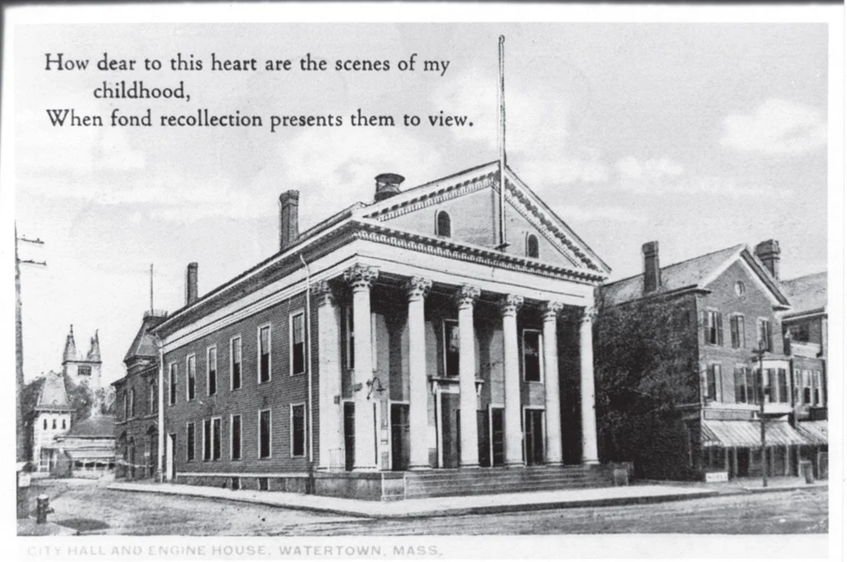
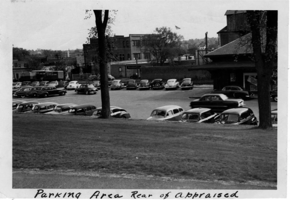
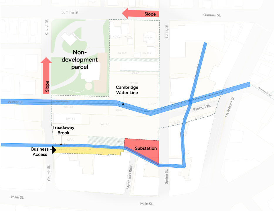
Image of the modern-day site limitations of the Demonstration Area
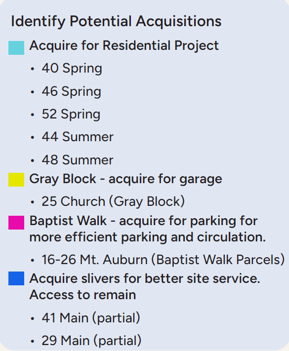
Site Challenges
Many parcels with a variety of owners
Multiple easements with use restrictions
Likely industrial contamination from former rail use under the parking lot (indications are the railway was simply backfilled and then tarmac poured)
Underground culverts and the Cambridge Aqueduct
Stormwater retention areas that would need to be moved
Electrical capacity limitations for both service delivery and solar generation
Topographical challenges
Implications of These Constraints
Existing easements and infrastructure limit the location of buildings, place constraints on vehicular movement, but open opportunities for pedestrian access and community gathering spaces.
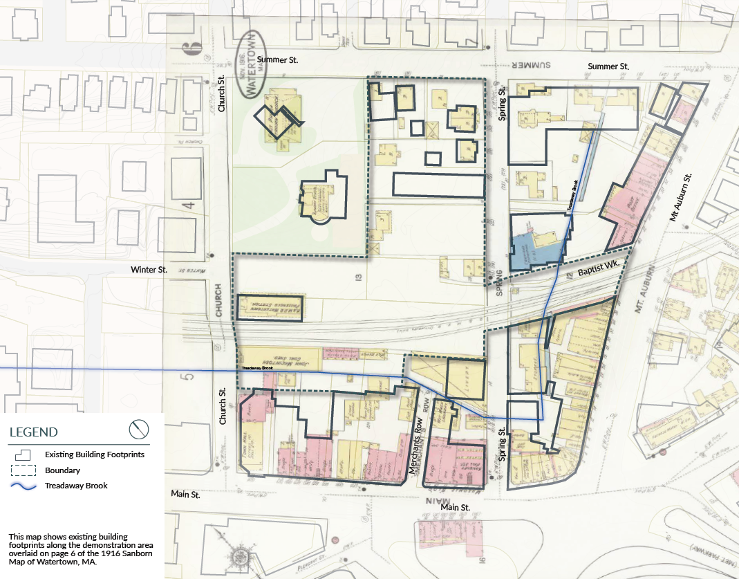
1916 Map of the Demonstration Project Area
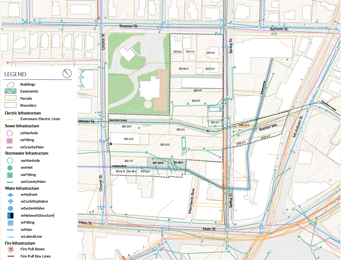
Map of the modern day infrastructure and constraints of the demonstration project area.
Demonstration Plan
A Demonstration Plan allows the City to test the feasibility of development in Watertown Square.
Why does Watertown need a Demonstration Project first?
The conceptual plan illustrates the community’s vision.
The Demonstration Project delves into what is feasible given the underlying conditions: ownership, zoning, subsurface infrastructure, and other site conditions.
Lessons learned in the Demonstration Project will inform the Urban Revitalization Plan.
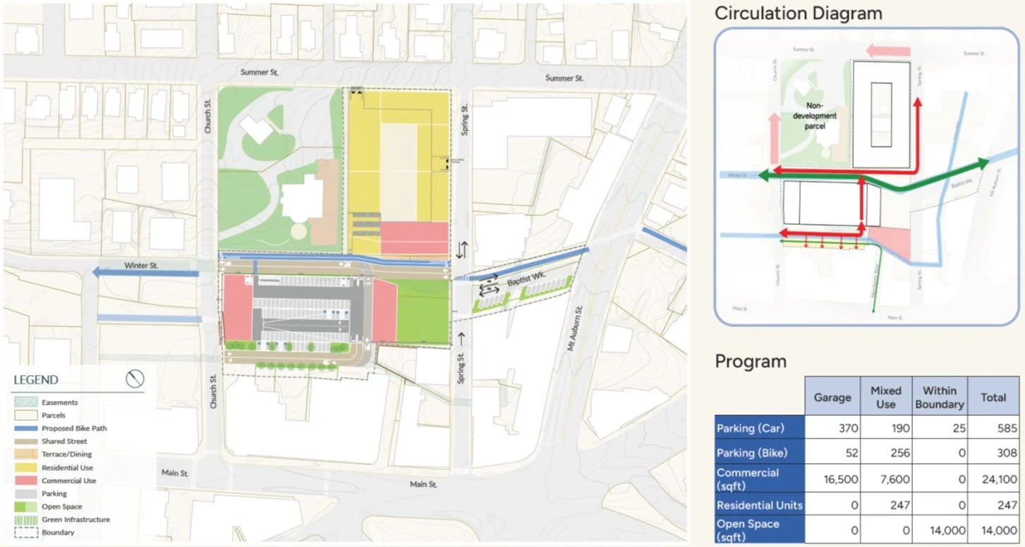
The Demonstration Project Area design considerations
Design Considerations
Standard Building Sizes
Double-loaded corridor residential allows efficiency and constructability
Pre-fab garage options lower cost
Retail depth for functionality
Allow for site circulation
Bicycle and pedestrian access
Garage access
Truck access for retail service
Aerial view of the Demonstration Project Area and all of its relevant parcels
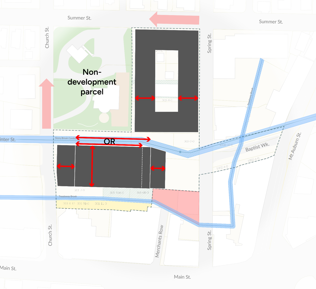
Demonstration Project Plan Fit Testing
Study Option 1
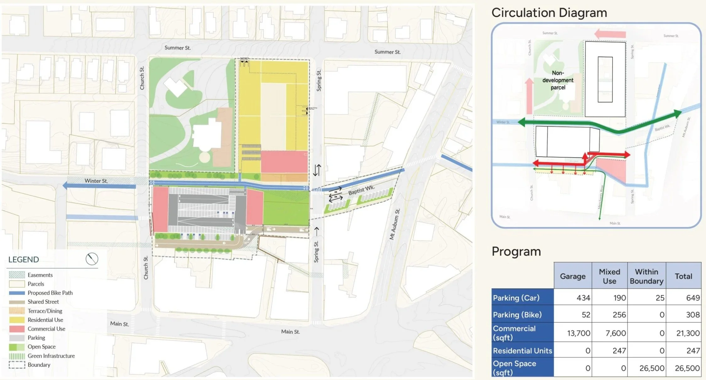
Study Option 2
Differences between the two above options
Key differences between Option A and Option B include the amount of green space, the pedestrian and vehicular circulation, and the retail square footage.
Urban Revitalization Plan
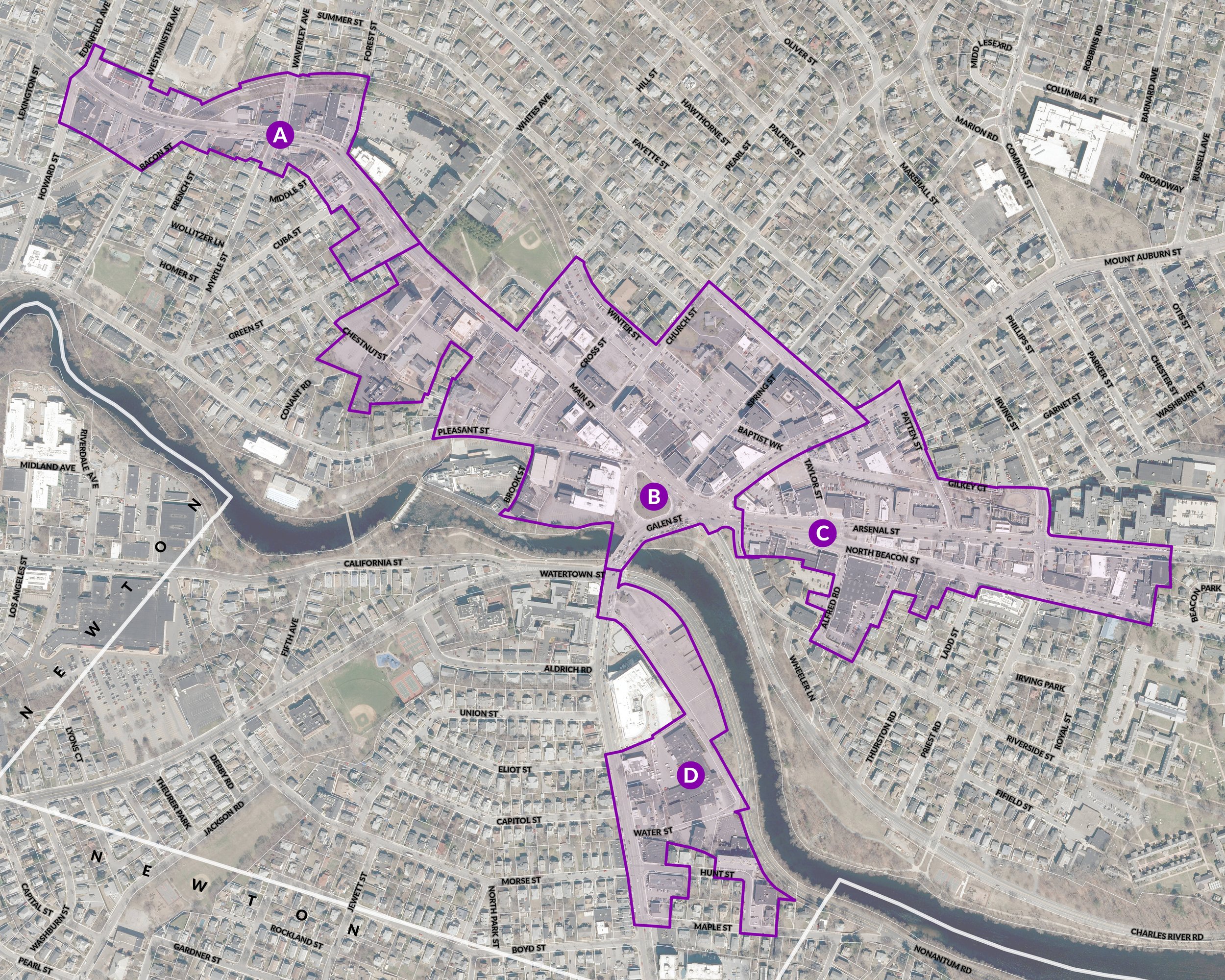
The Urban Revitalization Plan (URP) is the next stage of implementing the 2024 WATERTOWN SQUARE AREA PLAN. The expanded boundary includes four subdistricts. This division allows the City and the consultant team to investigate different characteristics and recommend appropriate strategies for each area.
Aerial View of the Proposed URP Boundary
Urban Revitalization Plan Next Steps
The next step is to look at the wider Watertown Square Area and create an Urban Revitalization Plan that unlocks public-private partnerships throughout the larger area, over a longer time.
What is an Urban Revitalization Plan (URP)?
Enabled by state legislation (MGL c. 128B) and must be prepared and updated according to EOHLC’s regulations (760 CMR 12.00).
Allows a Redevelopment Authority – Watertown’s City Council – to address conditions that the private market cannot address alone (defined as a Deteriorating Area, and Blighted Open Space, or a Substandard Area in the legislation).
Defines existing conditions, strategies to address those conditions, plan objectives, responsibilities for implementation, and parcels for acquisition and disposition.
Provides an additional level of partnership for new projects that allows the City to incentivize community benefits.
The Demonstration Project serves as a model for future public/ private partnerships in the larger URP area.
Good to Know
Watertown’s City Council must approve the plan, with input from the Planning Board.
After that, the Executive Office of Housing and Livable Communities (EOHLC) must also approve the plan.
The Massachusetts Environmental Protection Act (MEPA) Office must also review the plan under the Environmental Notification Form process.
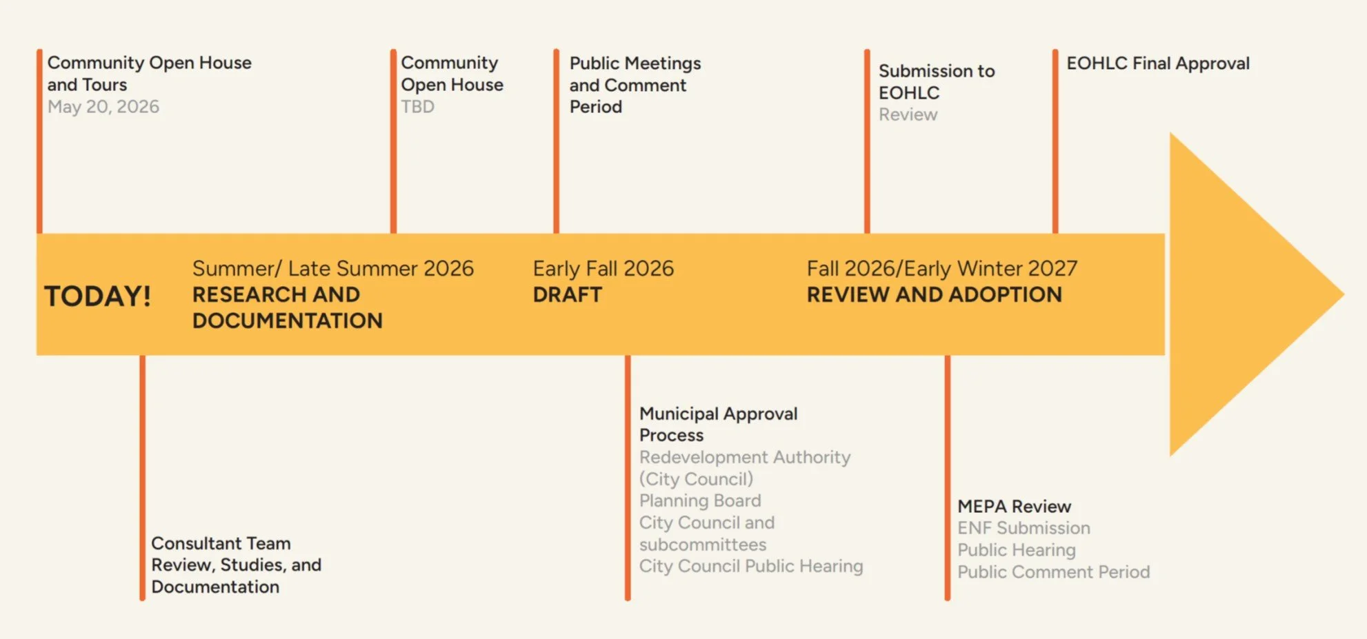
A drafted timeline of the Urban Revitalization Project.
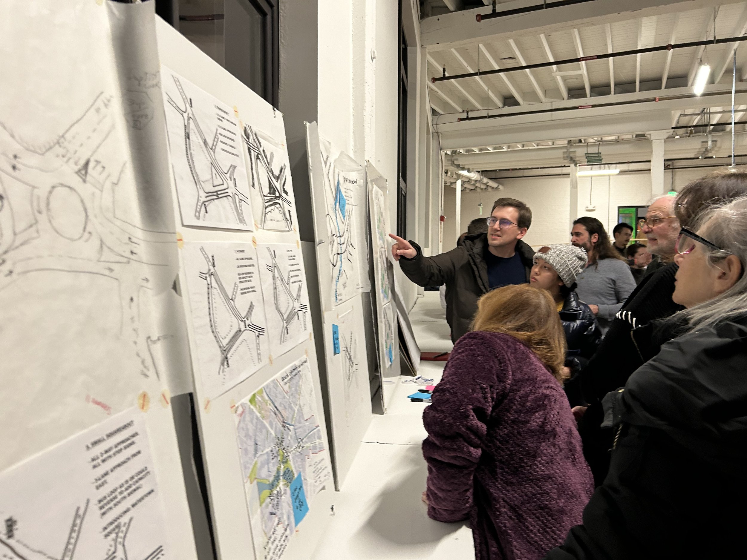
PArtake in the Virtual Tour of the Demonstration Project Area & Urban Revitalization Area
This virtual tour will take you through the Demonstration Project Area and highlight aspects of the proposed plan, as well as the portions of the Urban Revitalization Area to see conditions on the ground.
Thank you!
Thank you for participating in the virtual Open House for the Watertown Square Project. You can see the feedback we have received from the community thus far, as well as all of the boards presented at the Open House. If you wish to submit a comment, please feel free to do so. More information is regularly being released regarding this project and the City appreciates your continued engagement!